🗺 Driving time to the nearest Emergency Room (France)
Recently, I almost lost half my finger using a router—not the IT thing, the woodworking thing!!. My wife was not home so I just walked 15 minutes to the emergency room and got stitches. That’s it. But what if I lived in the countryside, far from any hospital?
December 12th is the International Universal Health Coverage Day, so I wanted to create a map of my country, France, that shows the driving time to the nearest emergency room to highlight how hospitals are unequally distributed on our territory.
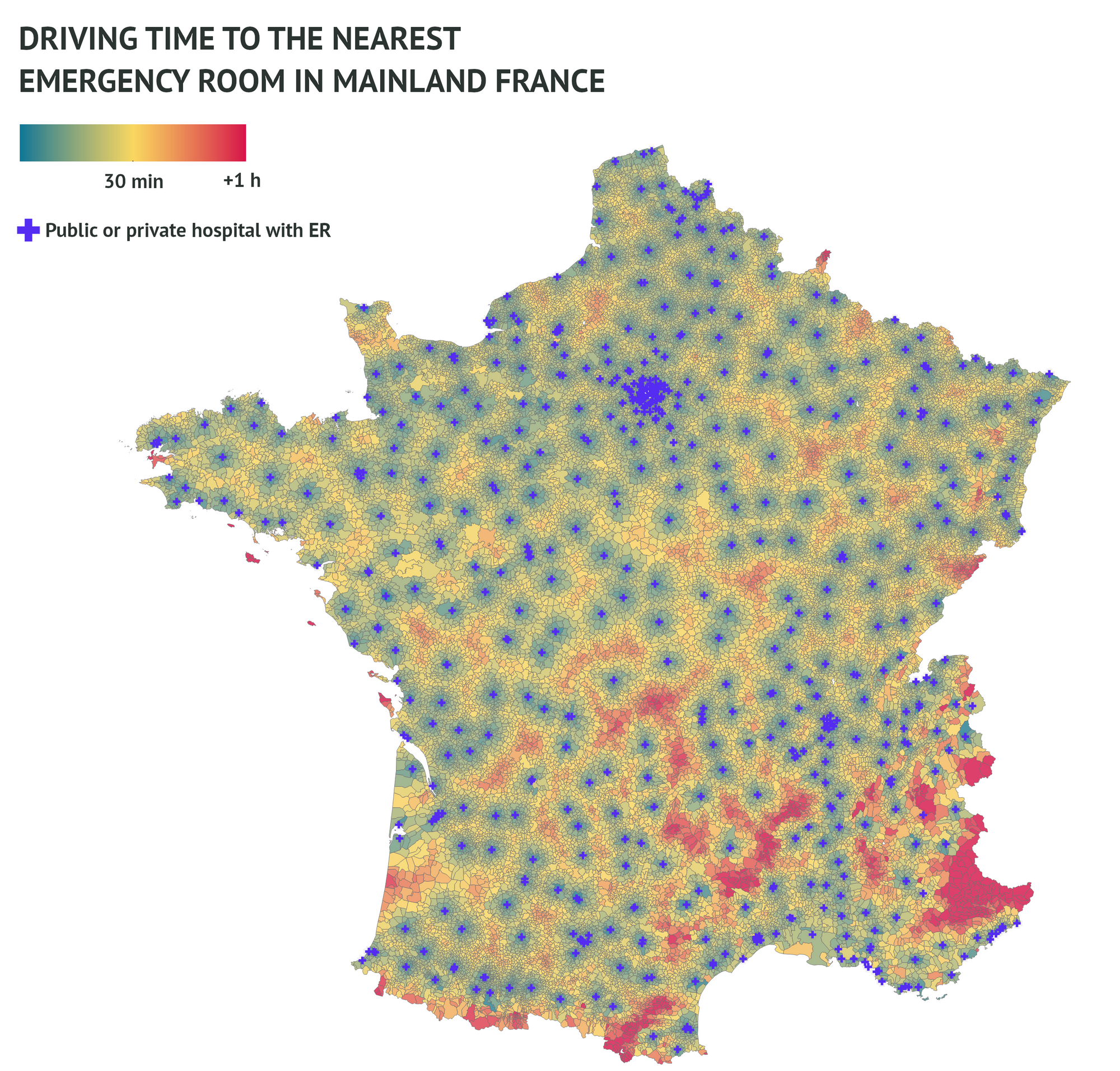
As expected, urban areas are better served and mountains are the most neglected areas. However, other regions that don’t seem as remote as the high Alps remain quite far away from any ER. For instance, in the Landes, in South-Western France, you need 55 minutes to drive from Mimizan to Arcachon hospital.
In general, the mean driving time is approximately 20 minutes, and 278 cities (less than 8%) are more than 1 hour away from any ER. Just keep in mind that 8% of cities is not 8% of the population as those cities are mainly remote little populated ones.
How I did the map
First I got the list of all French hospitals with an emergency room. Then I proceeded to calculate the geodesic distance between every 36k+ city in mainland France and every ER using the great Python library GeoPy. For each city, I kept the 3 closest ER because, the closest as the crow flies, might not be the nearest to drive to, especially in mountainous areas or on islands.
Then, I calculated the driving distances and kept the shortest one. I tried with the open OSRM API and Google Maps API. Unfortunately, the first one was quite slow (up to 2 seconds per request) and not so accurate. Sometimes, I got absurd driving distances, like 4 hours for 40 km… So, eventually I chose to use Google API, which is not free but offers $400 of credit when opening a developer account. For the map, I simply used Tableau and the official shapefile licensed by the French government.
Soon, an interactive map including Corsica and oversea territories will come.
Check my other maps on www.marchese.fr
Sources
Localisation of emergency rooms : https://www.data.gouv.fr/en/datasets/localisation-des-services-daccueil-des-urgences/